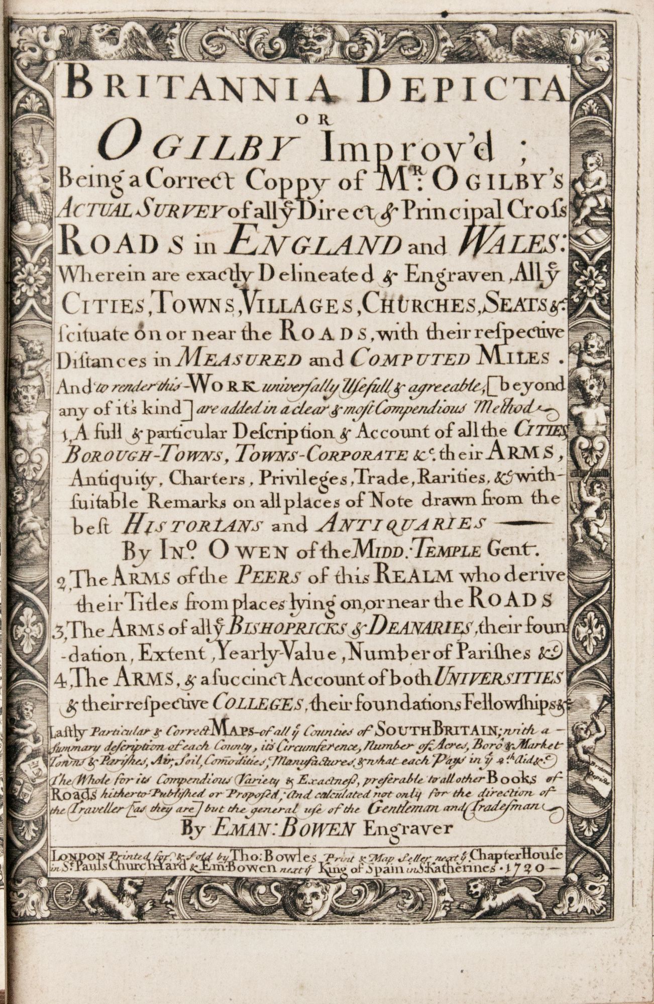

Britannia depicta or Ogilby improv’d; being a correct coppy of Mr. Ogilby’s Actual survey of all ye direct & principal cross roads in England and Wales: . . . And to render this—work universally usefull & agreeable, . . . are added . . . 1. A full & particular description & account of all the cities, borough-towns, towns-corporate . . . By Ino. Owen . . . 2. The arms of the peers of this realm . . . 3. The arms of all ye bishopricks & deanaries, . . . 4. The arms, & a succinct account of both universities & their respective colleges, . . . Lastly particular & correct maps of all ye counties of South Britain; with a—summary description of each county, . . . By Eman: Bowen engraver
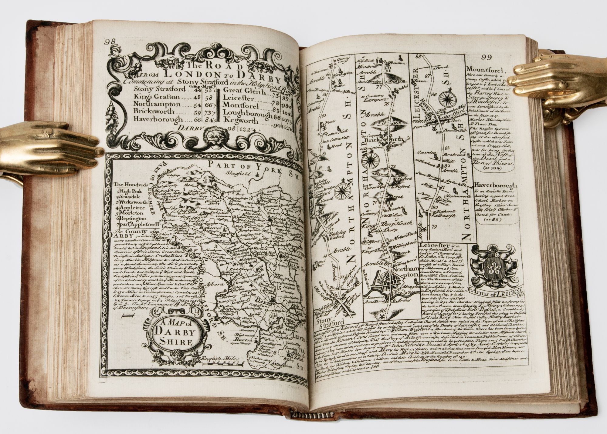
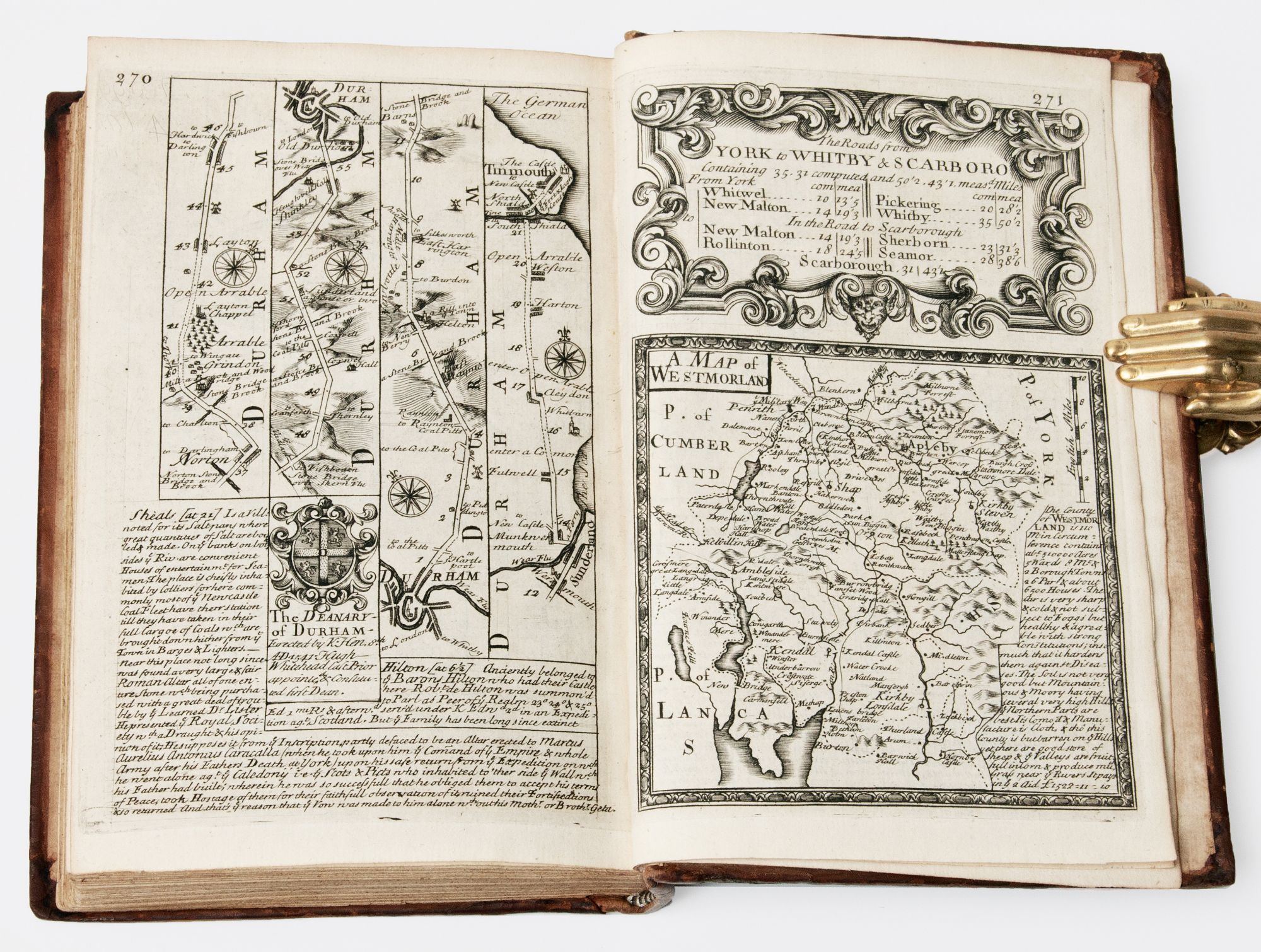
London: Printed for, & sold by Tho: Bowles print & map seller next ye. Chapter House in St. Pauls Church-Yard & Em. Bowen next ye King of Spain in S: Katherines, 1720. First Edition. Full Calf. First edition, first or second issue, of this fully and finely engraved road atlas of England and Wales, a smaller-format popular version of Ogilby's famous road atlas, originally published in two versions (both 1675), in folio editions. Small 4to (204 x 120mm): [6],273,[1]pp, comprising 54 county maps and associated suites of strip road maps in three or four columns over 273 plates engraved front and back by Emanuel Bowen. Contemporary Cambridge-style paneled calf, sympathetically rebacked, spine with five raised bands ruled in gilt, recent red morocco lettering piece gilt, all edges speckled red, plain period end papers. An all-together elaborate production, in Fine, clean, bright condition, each map fully and elaborately engraved by Emanuel Bowen and enhanced with little-known historical facts (supplied by the antiquarian John Owen), elaborate heraldic images, rococo cartouches and decorative borders. Scarce first or second issue, with “next ye King of Spain” in the imprint statement (later issues read “near ye Stairs in St. Katherine’s”). Issue points as follows: p. 8, Sussex 'rapes' [administrative boundaries] not numbered; plate 128 misnumbered 121 (and corrected in an early hand). As an entirely engraved production, chock-a-block with information, Britannia depicta or Ogilby improv’d was being constantly corrected and updated. Of the examples dated 1720, Hobson identifies eight variants laid out in six distinct ‘editions.' Hodson describes two issues of the first edition; ESTC adds a third.) Shirley (Printed maps of the British Isles, 1650-1750), pp. 103-04. Hodson 149. Tooley III, p. 345-47. Lister, p. 207. Fine. Item #BB0346
Ogilby's survey, undertaken to prepare the atlases, was perhaps the most accurate to date; he used the new distance of 1760 yards to a mile instead of the old standard of 2428 yards and calculated measurements methodically by foot. Because of public demand for these accurate strip road maps in a format conducive to travel, several smaller versions were published, with the present edition being one of the most successful. Bowen was official map engraver to both George II and Louis XV of France, producing some of the finest and most intricately engraved English county maps of his time. N. B. With few exceptions (always identified), we only stock books in exceptional condition. All orders are packaged with care and posted promptly. Satisfaction guaranteed. (Fine Editions Ltd is a member of the Independent Online Booksellers Association, and we subscribe to its codes of ethics.).
Price: $2,899.00