![Item #BB2504 [Thames] [Angling] The Oarsman’s and Angler’s Map of the River Thames from its Source to London Bridge. One inch to a mile. James REYNOLDS.](https://fineeditionsltd.cdn.bibliopolis.com/pictures/BB2504.jpeg?width=768&height=1000&fit=bounds&auto=webp&v=1632430252)
![[Thames] [Angling] The Oarsman’s and Angler’s Map of the River Thames from its Source to London Bridge. One inch to a mile](https://fineeditionsltd.cdn.bibliopolis.com/pictures/BB2504_2.jpeg?auto=webp&v=1632430252)
![[Thames] [Angling] The Oarsman’s and Angler’s Map of the River Thames from its Source to London Bridge. One inch to a mile](https://fineeditionsltd.cdn.bibliopolis.com/pictures/BB2504_3.jpeg?auto=webp&v=1632430252)
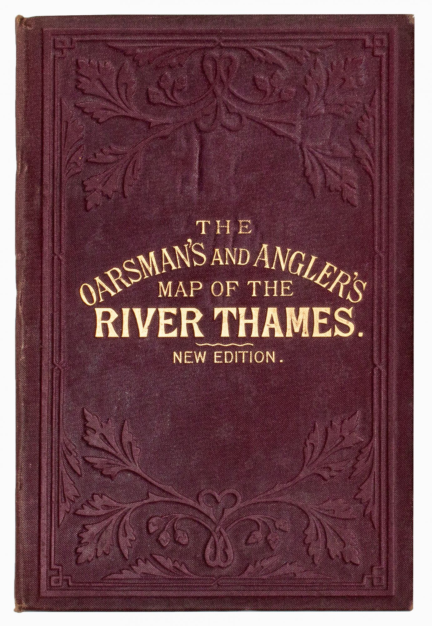
[Thames] [Angling] The Oarsman’s and Angler’s Map of the River Thames from its Source to London Bridge. One inch to a mile
London: James Reynolds & Sons, 174 Strand, 1885. Decorative Cloth. A beautifully preserved later issue of this multi-folding strip map, showing settlements along the river, from above Cricklade down to London Bridge, with locks, bridges, and rail lines, and including details of toll charges, angling laws, weirs, bathing spots, towpaths, ferries, water mills, and species of fish to be caught. Foolscap 8vo (160 x 100mm): [4]pp of rules and bye-laws, with superbly hand-colored lithographed folding map (160mm x 2600mm) in 26 sections mounted on linen. Publisher's blind-stamped brown cloth, upper cover lettered in gilt. Virtually pristine. Westwood & Satchell, p. 174 (noting editions of 1861 and 1876). Fine. Item #BB2504
New Edition of the map first produced in 1861 for James Reynolds by Ernest George Ravenstein (1834-1913), a German-born geographer and cartographer, who, in 1872, declined the position of chief cartographer at the Royal Geographical Society because he was refused permission to smoke on the premises. N. B. With few exceptions (always identified), we only stock books in exceptional condition, carefully preserved in archival, removable mylar sleeves. All orders are packaged with care and posted promptly. Satisfaction guaranteed. (Fine Editions Ltd is a member of the Independent Online Booksellers Association, and we subscribe to its codes of ethics.).
Price: $251.00